Our company offers advanced analysis and reporting services based on LiDAR technology in order to operate energy transmission lines safely, sustainably and in accordance with legislation. In this context, the route corridor through which transmission lines pass is mapped with high precision and detail using airborne LiDAR technology; multi-faceted evaluations are carried out on the obtained LiDAR point cloud data.
LiDAR Supported Energy Transmission Line (ETL) Corridor Analysis and Reporting Service
Scope of Service
With this service we provide, it is aimed to record the current status of the energy transmission lines under the responsibility of TEİAŞ General Directorate and analyze the effects of the construction, vegetation and environmental elements on the line corridor. Especially based on the electrical safety distances defined in the EKAT Regulation, risky areas are determined and reported in accordance with the relevant technical criteria. Corridor management ensures that the area where the transmission lines are located is evaluated from a holistic perspective. It allows for the early detection of whether the constructions along the line route violate the safety distance and to take precautions before they pose any risk to life and property. With this approach, it is aimed to prevent negative scenarios by ensuring the sustainability of the existing energy transmission corridor.
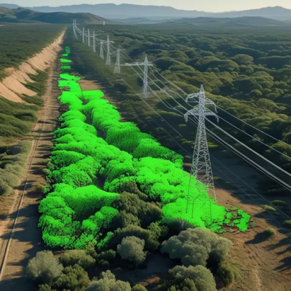
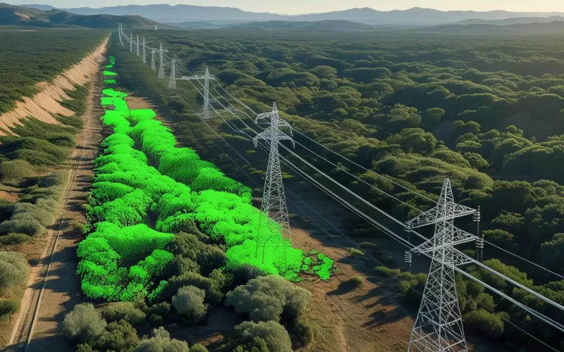
Similarly, vegetation management plays a critical role in the healthy operation of energy transmission lines. Trees and tall plants entering the corridor not only pose a risk of contact with conductors; they are also a significant threat as one of the causes of forest fires. Therefore, controlling vegetation around the transmission line is vital not only for network security but also for environmental security. Thanks to LiDAR-supported analyses, vegetation-related violations are detected with precision and proactive measures can be taken in areas with fire risk.
Technologies Used
- Dense point cloud generation with high precision airborne LiDAR scanning systems
- High Resolution Orthophoto generation for mapping
- GNSS/IMU based positioning infrastructure
- Enhanced web based analysis and visualization platform: LiDARVIEWER
Process and Outputs
During the corridor management process, the maximum physical conditions that transmission lines may be exposed to, especially at the conductor level, are analyzed in detail. The maximum deflection (sag) and windy swing scenarios of the conductors are evaluated by taking into account the electrical safety distances clearly stated in the EKAT Regulation. In this way, current, short and medium term potential contact or approach violations can be determined before the risk occurs and preventive actions can be planned. The current situation is presented in the most realistic way.